


FARMINGTON - T 2 Voting District, Jefferson County, Wisconsin
About
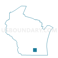
Outline

Summary
| Unique Area Identifier | 694229 |
| Name | FARMINGTON - T 2 Voting District |
| County | Jefferson County |
| State | Wisconsin |
| Area (square miles) | 14.74 |
| Land Area (square miles) | 14.65 |
| Water Area (square miles) | 0.09 |
| % of Land Area | 99.37 |
| % of Water Area | 0.63 |
| Latitude of the Internal Point | 43.06848540 |
| Longtitude of the Internal Point | -88.75171680 |
Maps


Graphs
Select a template below for downloading or customizing gragh for FARMINGTON - T 2 Voting District, Jefferson County, Wisconsin


Neighbors
Neighoring Voting District (by Name) Neighboring Voting District on the Map
- AZTALAN - T 1 Voting District, Jefferson County, WI
- FARMINGTON - T 1 Voting District, Jefferson County, WI
- JEFFERSON - T 2 Voting District, Jefferson County, WI
- Johnson Creek - V 1 Voting District, Jefferson County, WI
- Johnson Creek - V 2 Voting District, Jefferson County, WI
- MILFORD - T 2 Voting District, Jefferson County, WI
- WATERTOWN - T 1 Voting District, Jefferson County, WI
Top 10 Neighboring County Subdivision (by Population) Neighboring County Subdivision on the Map
- Johnson Creek village, Jefferson County, WI (2,738)
- Jefferson town, Jefferson County, WI (2,178)
- Watertown town, Jefferson County, WI (1,975)
- Aztalan town, Jefferson County, WI (1,457)
- Farmington town, Jefferson County, WI (1,380)
- Milford town, Jefferson County, WI (1,099)
Top 10 Neighboring Place (by Population) Neighboring Place on the Map
Top 10 Neighboring Unified School District (by Population) Neighboring Unified School District on the Map
- Watertown School District, WI (30,946)
- Jefferson School District, WI (13,305)
- Lake Mills Area School District, WI (9,268)
- Johnson Creek School District, WI (4,493)
Top 10 Neighboring State Legislative District Lower Chamber (by Population) Neighboring State Legislative District Lower Chamber on the Map
Top 10 Neighboring State Legislative District Upper Chamber (by Population) Neighboring State Legislative District Upper Chamber on the Map
Top 10 Neighboring 111th Congressional District (by Population) Neighboring 111th Congressional District on the Map
- Congressional District 2, WI (751,169)
- Congressional District 5, WI (707,580)
- Congressional District 6, WI (705,102)
Top 10 Neighboring Census Tract (by Population) Neighboring Census Tract on the Map
- Census Tract 1007, Jefferson County, WI (4,630)
- Census Tract 1010, Jefferson County, WI (3,881)
- Census Tract 1009, Jefferson County, WI (3,868)
- Census Tract 1017.01, Jefferson County, WI (1,385)